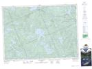
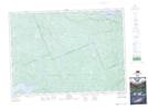
Maps showing Plover Creek, Nipissing, Ontario
Plover Creek is a River located in Nipissing, Ontario and has an elevation of 302 meters.
- Latitude: 45° 59' 56'' North (decimal: 45.9988888)
- Longitude: 78° 13' 58'' West (decimal: -78.2327777)
- Topography Feature Category: River
- Geographical Feature: Creek
- Canadian Province/Territory: Ontario
- Elevation: 302 meters
- Location: Nipissing
- Atlas of Canada Locator Map: Plover Creek
- GPS Coordinate Locator Map: Plover Creek Lat/Long
Plover Creek NTS Map Sheets