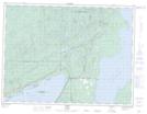
Maps showing Plumpuddin Hill, Thunder Bay, Ontario
Plumpuddin Hill is a Mountain located in Thunder Bay, Ontario.
- Latitude: 48° 44' 11'' North (decimal: 48.7363888)
- Longitude: 88° 39' 50'' West (decimal: -88.6638888)
- Topography Feature Category: Mountain
- Geographical Feature: Hill
- Canadian Province/Territory: Ontario
- Location: Thunder Bay
- Atlas of Canada Locator Map: Plumpuddin Hill
- GPS Coordinate Locator Map: Plumpuddin Hill Lat/Long