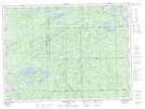
Maps showing Minnesota Bay, Algoma, Ontario
Minnesota Bay is a Bay located in Algoma, Ontario and has an elevation of 426 meters.
- Latitude: 48° 13' 21'' North (decimal: 48.2224999)
- Longitude: 85° 16' 58'' West (decimal: -85.2827777)
- Topography Feature Category: Bay
- Geographical Feature: Bay
- Canadian Province/Territory: Ontario
- Elevation: 426 meters
- Location: Algoma
- Atlas of Canada Locator Map: Minnesota Bay
- GPS Coordinate Locator Map: Minnesota Bay Lat/Long
Minnesota Bay NTS Map Sheets