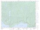
Maps showing Sawmill Creek, Thunder Bay, Ontario
Sawmill Creek is a River located in Thunder Bay, Ontario and has an elevation of 314 meters.
- Latitude: 48° 49' 31'' North (decimal: 48.8252777)
- Longitude: 86° 56' 35'' West (decimal: -86.9430555)
- Topography Feature Category: River
- Geographical Feature: Creek
- Canadian Province/Territory: Ontario
- Elevation: 314 meters
- Location: Thunder Bay
- Atlas of Canada Locator Map: Sawmill Creek
- GPS Coordinate Locator Map: Sawmill Creek Lat/Long