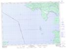
Maps showing Sawpit Bay, Algoma, Ontario
Sawpit Bay is a Bay located in Algoma, Ontario and has an elevation of 185 meters.
- Latitude: 46° 57' 53'' North (decimal: 46.9647222)
- Longitude: 84° 44' 55'' West (decimal: -84.7486111)
- Topography Feature Category: Bay
- Geographical Feature: Bay
- Canadian Province/Territory: Ontario
- Elevation: 185 meters
- Location: Algoma
- Atlas of Canada Locator Map: Sawpit Bay
- GPS Coordinate Locator Map: Sawpit Bay Lat/Long
Sawpit Bay NTS Map Sheets