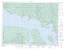
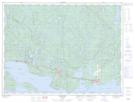
Maps showing Schreiber Channel, Thunder Bay, Ontario
Schreiber Channel is a Channel located in Thunder Bay, Ontario and has an elevation of 184 meters.
- Latitude: 48° 48' 21'' North (decimal: 48.8058333)
- Longitude: 87° 24' 34'' West (decimal: -87.4094444)
- Topography Feature Category: Channel
- Geographical Feature: Channel
- Canadian Province/Territory: Ontario
- Elevation: 184 meters
- Location: Thunder Bay
- Atlas of Canada Locator Map: Schreiber Channel
- GPS Coordinate Locator Map: Schreiber Channel Lat/Long
Schreiber Channel NTS Map Sheets