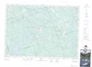
Maps showing Schutt, Renfrew, Ontario
Schutt is a Unincorporated area located in Renfrew, Ontario and has an elevation of 333 meters.
- Latitude: 45° 14' 48'' North (decimal: 45.2466666)
- Longitude: 77° 27' 41'' West (decimal: -77.4613888)
- Topography Feature Category: Unincorporated area
- Geographical Feature: Dispersed Rural Community
- Canadian Province/Territory: Ontario
- Elevation: 333 meters
- Location: Renfrew
- Atlas of Canada Locator Map: Schutt
- GPS Coordinate Locator Map: Schutt Lat/Long