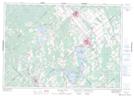
Maps showing Schuyler Lake, Lanark, Ontario
Schuyler Lake is a Lake located in Lanark, Ontario and has an elevation of 198 meters.
- Latitude: 45° 12' 38'' North (decimal: 45.2105555)
- Longitude: 76° 27' 36'' West (decimal: -76.4599999)
- Topography Feature Category: Lake
- Geographical Feature: Lake
- Canadian Province/Territory: Ontario
- Elevation: 198 meters
- Location: Lanark
- Atlas of Canada Locator Map: Schuyler Lake
- GPS Coordinate Locator Map: Schuyler Lake Lat/Long
Schuyler Lake NTS Map Sheets