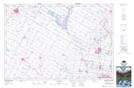
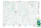
Maps showing Middle Maitland River, Huron, Ontario
Middle Maitland River is a River located in Huron, Ontario and has an elevation of 396 meters.
- Latitude: 43° 53' 9'' North (decimal: 43.8858333)
- Longitude: 81° 19' 28'' West (decimal: -81.3244444)
- Topography Feature Category: River
- Geographical Feature: River
- Canadian Province/Territory: Ontario
- Elevation: 396 meters
- Location: Huron
- Atlas of Canada Locator Map: Middle Maitland River
- GPS Coordinate Locator Map: Middle Maitland River Lat/Long
Middle Maitland River NTS Map Sheets