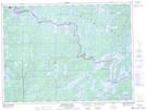
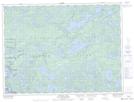
Maps showing Middle Roland Lake, Rainy River, Ontario
Middle Roland Lake is a Lake located in Rainy River, Ontario and has an elevation of 396 meters.
- Latitude: 48° 15' 11'' North (decimal: 48.2530555)
- Longitude: 91° 51' 41'' West (decimal: -91.8613888)
- Topography Feature Category: Lake
- Geographical Feature: Lake
- Canadian Province/Territory: Ontario
- Elevation: 396 meters
- Location: Rainy River
- Atlas of Canada Locator Map: Middle Roland Lake
- GPS Coordinate Locator Map: Middle Roland Lake Lat/Long
Middle Roland Lake NTS Map Sheets