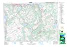
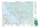
Maps showing Midland Bay, Simcoe, Ontario
Midland Bay is a Bay located in Simcoe, Ontario and has an elevation of 186 meters.
- Latitude: 44° 45' 59'' North (decimal: 44.7663888)
- Longitude: 79° 51' 33'' West (decimal: -79.8591666)
- Topography Feature Category: Bay
- Geographical Feature: Bay
- Canadian Province/Territory: Ontario
- Elevation: 186 meters
- Location: Simcoe
- Atlas of Canada Locator Map: Midland Bay
- GPS Coordinate Locator Map: Midland Bay Lat/Long
Midland Bay NTS Map Sheets