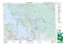
Maps showing Midland Bay Shoal, Simcoe, Ontario
Midland Bay Shoal is a Shoal located in Simcoe, Ontario.
- Latitude: 44° 45' 48'' North (decimal: 44.7633333)
- Longitude: 79° 52' 45'' West (decimal: -79.8791666)
- Topography Feature Category: Shoal
- Geographical Feature: Shoal
- Canadian Province/Territory: Ontario
- Location: Simcoe
- Atlas of Canada Locator Map: Midland Bay Shoal
- GPS Coordinate Locator Map: Midland Bay Shoal Lat/Long
Midland Bay Shoal NTS Map Sheets