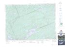
Maps showing Merdie Creek, Haliburton, Ontario
Merdie Creek is a River located in Haliburton, Ontario and has an elevation of 392 meters.
- Latitude: 45° 19' 56'' North (decimal: 45.3322222)
- Longitude: 78° 37' 13'' West (decimal: -78.6202777)
- Topography Feature Category: River
- Geographical Feature: Creek
- Canadian Province/Territory: Ontario
- Elevation: 392 meters
- Location: Haliburton
- Atlas of Canada Locator Map: Merdie Creek
- GPS Coordinate Locator Map: Merdie Creek Lat/Long
Merdie Creek NTS Map Sheets