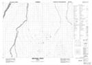
Maps showing Metapeskegau Creek, Cochrane, Ontario
Metapeskegau Creek is a River located in Cochrane, Ontario.
- Latitude: 50° 51' 17'' North (decimal: 50.8547222)
- Longitude: 80° 53' 53'' West (decimal: -80.8980555)
- Topography Feature Category: River
- Geographical Feature: Creek
- Canadian Province/Territory: Ontario
- Location: Cochrane
- Atlas of Canada Locator Map: Metapeskegau Creek
- GPS Coordinate Locator Map: Metapeskegau Creek Lat/Long
Metapeskegau Creek NTS Map Sheets