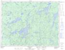
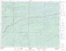
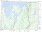
Maps showing Little Postagoni River, Thunder Bay, Ontario
Little Postagoni River is a River located in Thunder Bay, Ontario and has an elevation of 374 meters.
- Latitude: 49° 26' 13'' North (decimal: 49.4369444)
- Longitude: 88° 2' 38'' West (decimal: -88.0438888)
- Topography Feature Category: River
- Geographical Feature: River
- Canadian Province/Territory: Ontario
- Elevation: 374 meters
- Location: Thunder Bay
- Atlas of Canada Locator Map: Little Postagoni River
- GPS Coordinate Locator Map: Little Postagoni River Lat/Long
Little Postagoni River NTS Map Sheets