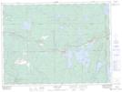
Maps showing Mist Creek, Timiskaming, Ontario
Mist Creek is a River located in Timiskaming, Ontario and has an elevation of 324 meters.
- Latitude: 48° 12' 52'' North (decimal: 48.2144444)
- Longitude: 79° 33' 46'' West (decimal: -79.5627777)
- Topography Feature Category: River
- Geographical Feature: Creek
- Canadian Province/Territory: Ontario
- Elevation: 324 meters
- Location: Timiskaming
- Atlas of Canada Locator Map: Mist Creek
- GPS Coordinate Locator Map: Mist Creek Lat/Long
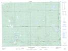
Mist Creek NTS Map Sheets