Maps showing Mocassets Landing, Manitoulin, Ontario
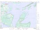
Mocassets Landing is a Marine navigation feature located in Manitoulin, Ontario.
- Latitude: 45° 45' 1'' North (decimal: 45.7502777)
- Longitude: 81° 47' 4'' West (decimal: -81.7844444)
- Topography Feature Category: Marine navigation feature
- Geographical Feature: Landing
- Canadian Province/Territory: Ontario
- Location: Manitoulin
- Atlas of Canada Locator Map: Mocassets Landing
- GPS Coordinate Locator Map: Mocassets Landing Lat/Long
Mocassets Landing NTS Map Sheets