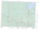
Maps showing Mokomon Lake, Ontario
Mokomon Lake is a Lake located in Ontario and has an elevation of 439 meters.
- Latitude: 48° 31' 1'' North (decimal: 48.5169000)
- Longitude: 89° 30' 48'' West (decimal: -89.5133000)
- Topography Feature Category: Lake
- Geographical Feature: Lake
- Canadian Province/Territory: Ontario
- Elevation: 439 meters
- GPS Coordinate Locator Map: Mokomon Lake Lat/Long
Mokomon Lake NTS Map Sheets