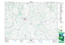
Maps showing Molesworth, Perth; Huron, Ontario
Molesworth is a Unincorporated area located in Perth; Huron, Ontario and has an elevation of 357 meters.
- Latitude: 43° 46' 51'' North (decimal: 43.7808333)
- Longitude: 81° 4' 18'' West (decimal: -81.0716666)
- Topography Feature Category: Unincorporated area
- Geographical Feature: Dispersed Rural Community
- Canadian Province/Territory: Ontario
- Elevation: 357 meters
- Location: Perth; Huron
- Atlas of Canada Locator Map: Molesworth
- GPS Coordinate Locator Map: Molesworth Lat/Long