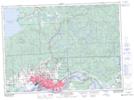
Maps showing St. Joe Lake, Algoma, Ontario
St. Joe Lake is a Lake located in Algoma, Ontario and has an elevation of 343 meters.
- Latitude: 46° 37' 27'' North (decimal: 46.6241666)
- Longitude: 84° 13' 16'' West (decimal: -84.2211111)
- Topography Feature Category: Lake
- Geographical Feature: Lake
- Canadian Province/Territory: Ontario
- Elevation: 343 meters
- Location: Algoma
- Atlas of Canada Locator Map: St. Joe Lake
- GPS Coordinate Locator Map: St. Joe Lake Lat/Long
St. Joe Lake NTS Map Sheets