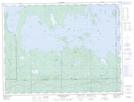
Maps showing St. Patrick Island, Cochrane, Ontario
St. Patrick Island is a Island located in Cochrane, Ontario and has an elevation of 274 meters.
- Latitude: 48° 39' 16'' North (decimal: 48.6544444)
- Longitude: 79° 40' 7'' West (decimal: -79.6686111)
- Topography Feature Category: Island
- Geographical Feature: Island
- Canadian Province/Territory: Ontario
- Elevation: 274 meters
- Location: Cochrane
- Atlas of Canada Locator Map: St. Patrick Island
- GPS Coordinate Locator Map: St. Patrick Island Lat/Long
St. Patrick Island NTS Map Sheets