Canada Topographic Maps

Onaman Lake Topo Maps

Topography maps and Latitude/Longitude Location

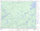
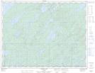
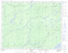
Maps showing Onaman Lake, Thunder Bay, Ontario

Onaman Lake is a Lake located in Thunder Bay, Ontario and has an elevation of 334 meters.

  • Latitude: 50° 0' 17'' North   (decimal: 50.0047222)
  • Longitude: 87° 26' 9'' West   (decimal: -87.4358333)
  • Topography Feature Category: Lake
  • Geographical Feature: Lake
  • Canadian Province/Territory: Ontario
  • Elevation: 334 meters
  • Location: Thunder Bay
  • Atlas of Canada Locator Map: Onaman Lake
  • GPS Coordinate Locator Map: Onaman Lake Lat/Long

Onaman Lake NTS Map Sheets

042E13 North Wind Lake Topographic Map at 1:50,000 scale

042E14 Treptow Lake Topographic Map at 1:50,000 scale

042L03 Kowkash Topographic Map at 1:50,000 scale

042L04 Elbow Lake Topographic Map at 1:50,000 scale

042E Longlac Topographic Map at 1:250,000 scale

042L Nakina Topographic Map at 1:250,000 scale

 
Buy Topographic Maps DVD
Newsletter Sign-up

Yes, I want to receive map store discounts.


Bookmark and Share