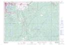
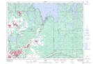
Maps showing Nickel Centre, Sudbury, Ontario
Nickel Centre is a Unincorporated area located in Sudbury, Ontario.
- Latitude: 46° 33' 4'' North (decimal: 46.5511111)
- Longitude: 80° 49' 6'' West (decimal: -80.8183333)
- Topography Feature Category: Unincorporated area
- Geographical Feature: Community
- Canadian Province/Territory: Ontario
- Location: Sudbury
- Atlas of Canada Locator Map: Nickel Centre
- GPS Coordinate Locator Map: Nickel Centre Lat/Long
Nickel Centre NTS Map Sheets