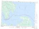
Maps showing O'Donnell Bank, Algoma, Ontario
O'Donnell Bank is a Shoal located in Algoma, Ontario.
- Latitude: 46° 8' 16'' North (decimal: 46.1377777)
- Longitude: 83° 46' 11'' West (decimal: -83.7697222)
- Topography Feature Category: Shoal
- Geographical Feature: Bank
- Canadian Province/Territory: Ontario
- Location: Algoma
- Atlas of Canada Locator Map: O'Donnell Bank
- GPS Coordinate Locator Map: O'Donnell Bank Lat/Long
O'Donnell Bank NTS Map Sheets