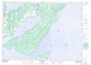
Maps showing Little Bluff, Manitoulin, Ontario
Little Bluff is a Cliff located in Manitoulin, Ontario and has an elevation of 191 meters.
- Latitude: 45° 32' 50'' North (decimal: 45.5472222)
- Longitude: 81° 47' 16'' West (decimal: -81.7877777)
- Topography Feature Category: Cliff
- Geographical Feature: Bluff
- Canadian Province/Territory: Ontario
- Elevation: 191 meters
- Location: Manitoulin
- Atlas of Canada Locator Map: Little Bluff
- GPS Coordinate Locator Map: Little Bluff Lat/Long
Little Bluff NTS Map Sheets