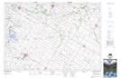
Maps showing St. Columban, Huron; Perth, Ontario
St. Columban is a Unincorporated area located in Huron; Perth, Ontario and has an elevation of 329 meters.
- Latitude: 43° 31' 24'' North (decimal: 43.5233333)
- Longitude: 81° 19' 23'' West (decimal: -81.3230555)
- Topography Feature Category: Unincorporated area
- Geographical Feature: Dispersed Rural Community
- Canadian Province/Territory: Ontario
- Elevation: 329 meters
- Location: Huron; Perth
- Atlas of Canada Locator Map: St. Columban
- GPS Coordinate Locator Map: St. Columban Lat/Long