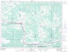
Maps showing Emo, Rainy River, Ontario
Emo is a Unincorporated area located in Rainy River, Ontario and has an elevation of 334 meters.
- Latitude: 48° 37' 56'' North (decimal: 48.6322222)
- Longitude: 93° 50' 14'' West (decimal: -93.8372222)
- Topography Feature Category: Unincorporated area
- Geographical Feature: Compact Rural Community
- Canadian Province/Territory: Ontario
- Elevation: 334 meters
- Location: Rainy River
- Atlas of Canada Locator Map: Emo
- GPS Coordinate Locator Map: Emo Lat/Long
Emo NTS Map Sheets