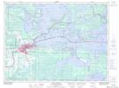
Maps showing Nishkongdaigong Point, Rainy River, Ontario
Nishkongdaigong Point is a Cape located in Rainy River, Ontario and has an elevation of 346 meters.
- Latitude: 48° 39' 47'' North (decimal: 48.6630555)
- Longitude: 93° 21' 41'' West (decimal: -93.3613888)
- Topography Feature Category: Cape
- Geographical Feature: Peninsula
- Canadian Province/Territory: Ontario
- Elevation: 346 meters
- Location: Rainy River
- Atlas of Canada Locator Map: Nishkongdaigong Point
- GPS Coordinate Locator Map: Nishkongdaigong Point Lat/Long
Nishkongdaigong Point NTS Map Sheets