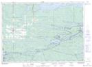
Maps showing Squaw Island, Nipissing, Ontario
Squaw Island is a Island located in Nipissing, Ontario and has an elevation of 205 meters.
- Latitude: 46° 13' 12'' North (decimal: 46.2200000)
- Longitude: 80° 16' 55'' West (decimal: -80.2819000)
- Topography Feature Category: Island
- Geographical Feature: Island
- Canadian Province/Territory: Ontario
- Elevation: 205 meters
- Location: Nipissing
- GPS Coordinate Locator Map: Squaw Island Lat/Long