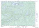
Maps showing Brush Camp Lake, Ontario
Brush Camp Lake is a Lake located in Ontario and has an elevation of 212 meters.
- Latitude: 46° 5' 57'' North (decimal: 46.0991999)
- Longitude: 81° 13' 58'' West (decimal: -81.2327999)
- Topography Feature Category: Lake
- Geographical Feature: Lake
- Canadian Province/Territory: Ontario
- Elevation: 212 meters
- GPS Coordinate Locator Map: Brush Camp Lake Lat/Long
Brush Camp Lake NTS Map Sheets