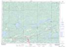
Maps showing Big Bend, Sudbury, Ontario
Big Bend is a River feature located in Sudbury, Ontario and has an elevation of 238 meters.
- Latitude: 46° 20' 37'' North (decimal: 46.3436111)
- Longitude: 81° 51' 44'' West (decimal: -81.8622222)
- Topography Feature Category: River feature
- Geographical Feature: Bend
- Canadian Province/Territory: Ontario
- Elevation: 238 meters
- Location: Sudbury
- Atlas of Canada Locator Map: Big Bend
- GPS Coordinate Locator Map: Big Bend Lat/Long