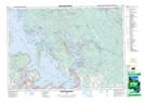
Maps showing Big Gully, Simcoe, Ontario
Big Gully is a Low vegetation located in Simcoe, Ontario and has an elevation of 213 meters.
- Latitude: 44° 49' 50'' North (decimal: 44.8305555)
- Longitude: 79° 32' 23'' West (decimal: -79.5397222)
- Topography Feature Category: Low vegetation
- Geographical Feature: Marsh
- Canadian Province/Territory: Ontario
- Elevation: 213 meters
- Location: Simcoe
- Atlas of Canada Locator Map: Big Gully
- GPS Coordinate Locator Map: Big Gully Lat/Long
Big Gully NTS Map Sheets