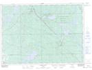
Maps showing Camp Nine Lake, Nipissing, Ontario
Camp Nine Lake is a Lake located in Nipissing, Ontario and has an elevation of 305 meters.
- Latitude: 46° 39' 20'' North (decimal: 46.6555555)
- Longitude: 79° 49' 29'' West (decimal: -79.8247222)
- Topography Feature Category: Lake
- Geographical Feature: Lake
- Canadian Province/Territory: Ontario
- Elevation: 305 meters
- Location: Nipissing
- Atlas of Canada Locator Map: Camp Nine Lake
- GPS Coordinate Locator Map: Camp Nine Lake Lat/Long
Camp Nine Lake NTS Map Sheets