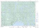
Maps showing Jack's Bay, Sudbury, Ontario
Jack's Bay is a Bay located in Sudbury, Ontario and has an elevation of 294 meters.
- Latitude: 46° 48' 20'' North (decimal: 46.8055555)
- Longitude: 80° 31' 52'' West (decimal: -80.5311111)
- Topography Feature Category: Bay
- Geographical Feature: Bay
- Canadian Province/Territory: Ontario
- Elevation: 294 meters
- Location: Sudbury
- Atlas of Canada Locator Map: Jack's Bay
- GPS Coordinate Locator Map: Jack's Bay Lat/Long