Canada Topographic Maps

Kolari Bay Topo Maps

Topography maps and Latitude/Longitude Location

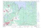
Maps showing Kolari Bay, Ontario

Kolari Bay is a Bay located in Ontario.

  • Latitude: 46° 41' 7'' North   (decimal: 46.6852999)
  • Longitude: 80° 44' 20'' West   (decimal: -80.7389000)
  • Topography Feature Category: Bay
  • Geographical Feature: Bay
  • Canadian Province/Territory: Ontario
  • GPS Coordinate Locator Map: Kolari Bay Lat/Long

Kolari Bay NTS Map Sheets

041I10 Capreol Topographic Map at 1:50,000 scale

041I Sudbury Topographic Map at 1:250,000 scale

 
Buy Topographic Maps DVD
Newsletter Sign-up

Yes, I want to receive map store discounts.


Bookmark and Share