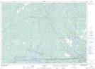
Maps showing Little Moose Bay, Sudbury, Ontario
Little Moose Bay is a Bay located in Sudbury, Ontario and has an elevation of 183 meters.
- Latitude: 46° 1' 50'' North (decimal: 46.0305555)
- Longitude: 80° 54' 39'' West (decimal: -80.9108333)
- Topography Feature Category: Bay
- Geographical Feature: Bay
- Canadian Province/Territory: Ontario
- Elevation: 183 meters
- Location: Sudbury
- Atlas of Canada Locator Map: Little Moose Bay
- GPS Coordinate Locator Map: Little Moose Bay Lat/Long