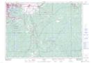
Maps showing Picnic Island, Sudbury, Ontario
Picnic Island is a Island located in Sudbury, Ontario and has an elevation of 217 meters.
- Latitude: 46° 24' 35'' North (decimal: 46.4097222)
- Longitude: 80° 33' 49'' West (decimal: -80.5636111)
- Topography Feature Category: Island
- Geographical Feature: Island
- Canadian Province/Territory: Ontario
- Elevation: 217 meters
- Location: Sudbury
- Atlas of Canada Locator Map: Picnic Island
- GPS Coordinate Locator Map: Picnic Island Lat/Long