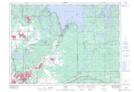
Maps showing Sloan's Island, Sudbury, Ontario
Sloan's Island is a Island located in Sudbury, Ontario and has an elevation of 297 meters.
- Latitude: 46° 44' 45'' North (decimal: 46.7458333)
- Longitude: 80° 32' 19'' West (decimal: -80.5386111)
- Topography Feature Category: Island
- Geographical Feature: Island
- Canadian Province/Territory: Ontario
- Elevation: 297 meters
- Location: Sudbury
- Atlas of Canada Locator Map: Sloan's Island
- GPS Coordinate Locator Map: Sloan's Island Lat/Long