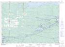
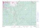
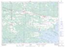
Maps showing West Arm, Sudbury, Ontario
West Arm is a Bay located in Sudbury, Ontario and has an elevation of 205 meters.
- Latitude: 46° 15' 33'' North (decimal: 46.2591666)
- Longitude: 80° 25' 9'' West (decimal: -80.4191666)
- Topography Feature Category: Bay
- Geographical Feature: Arm
- Canadian Province/Territory: Ontario
- Elevation: 205 meters
- Location: Sudbury
- Atlas of Canada Locator Map: West Arm
- GPS Coordinate Locator Map: West Arm Lat/Long
West Arm NTS Map Sheets