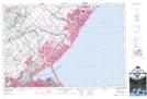
Maps showing Lakeside Creek, Peel, Ontario
Lakeside Creek is a River located in Peel, Ontario.
- Latitude: 43° 29' 32'' North (decimal: 43.4922222)
- Longitude: 79° 36' 53'' West (decimal: -79.6147222)
- Topography Feature Category: River
- Geographical Feature: Creek
- Canadian Province/Territory: Ontario
- Location: Peel
- Atlas of Canada Locator Map: Lakeside Creek
- GPS Coordinate Locator Map: Lakeside Creek Lat/Long
Lakeside Creek NTS Map Sheets