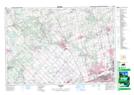
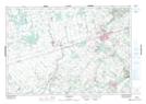
Maps showing Credit River (Erin Branch), Peel; Wellington, Ontario
Credit River (Erin Branch) is a River located in Peel; Wellington, Ontario and has an elevation of 401 meters.
- Latitude: 43° 48' 10'' North (decimal: 43.8027777)
- Longitude: 79° 59' 41'' West (decimal: -79.9947222)
- Topography Feature Category: River
- Geographical Feature: River
- Canadian Province/Territory: Ontario
- Elevation: 401 meters
- Location: Peel; Wellington
- Atlas of Canada Locator Map: Credit River (Erin Branch)
- GPS Coordinate Locator Map: Credit River (Erin Branch) Lat/Long
Credit River (Erin Branch) NTS Map Sheets