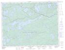
Maps showing Sommers Point, Rainy River, Ontario
Sommers Point is a Cape located in Rainy River, Ontario.
- Latitude: 48° 40' 56'' North (decimal: 48.6822222)
- Longitude: 91° 12' 39'' West (decimal: -91.2108333)
- Topography Feature Category: Cape
- Geographical Feature: Point
- Canadian Province/Territory: Ontario
- Location: Rainy River
- Atlas of Canada Locator Map: Sommers Point
- GPS Coordinate Locator Map: Sommers Point Lat/Long
Sommers Point NTS Map Sheets