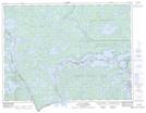
Maps showing Quetico Rapids, Rainy River, Ontario
Quetico Rapids is a Rapids located in Rainy River, Ontario and has an elevation of 357 meters.
- Latitude: 48° 27' 17'' North (decimal: 48.4547222)
- Longitude: 92° 16' 58'' West (decimal: -92.2827777)
- Topography Feature Category: Rapids
- Geographical Feature: Rapids
- Canadian Province/Territory: Ontario
- Elevation: 357 meters
- Location: Rainy River
- Atlas of Canada Locator Map: Quetico Rapids
- GPS Coordinate Locator Map: Quetico Rapids Lat/Long
Quetico Rapids NTS Map Sheets