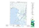
Maps showing Babys Point, Lambton, Ontario
Babys Point is a Cape located in Lambton, Ontario and has an elevation of 180 meters.
- Latitude: 42° 38' 13'' North (decimal: 42.6369444)
- Longitude: 82° 30' 18'' West (decimal: -82.5049999)
- Topography Feature Category: Cape
- Geographical Feature: Point
- Canadian Province/Territory: Ontario
- Elevation: 180 meters
- Location: Lambton
- Atlas of Canada Locator Map: Babys Point
- GPS Coordinate Locator Map: Babys Point Lat/Long
Babys Point NTS Map Sheets