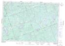
Maps showing Bateman's Island, Hastings, Ontario
Bateman's Island is a Island located in Hastings, Ontario and has an elevation of 325 meters.
- Latitude: 44° 49' 28'' North (decimal: 44.8244444)
- Longitude: 77° 40' 54'' West (decimal: -77.6816666)
- Topography Feature Category: Island
- Geographical Feature: Island
- Canadian Province/Territory: Ontario
- Elevation: 325 meters
- Location: Hastings
- Atlas of Canada Locator Map: Bateman's Island
- GPS Coordinate Locator Map: Bateman's Island Lat/Long