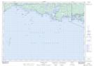
Maps showing Batt Bay, Parry Sound, Ontario
Batt Bay is a Bay located in Parry Sound, Ontario and has an elevation of 178 meters.
- Latitude: 45° 56' 30'' North (decimal: 45.9416666)
- Longitude: 81° 3' 54'' West (decimal: -81.0649999)
- Topography Feature Category: Bay
- Geographical Feature: Bay
- Canadian Province/Territory: Ontario
- Elevation: 178 meters
- Location: Parry Sound
- Atlas of Canada Locator Map: Batt Bay
- GPS Coordinate Locator Map: Batt Bay Lat/Long
Batt Bay NTS Map Sheets