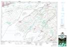
Maps showing Bayfield Shoal, Frontenac, Ontario
Bayfield Shoal is a Shoal located in Frontenac, Ontario.
- Latitude: 44° 13' 46'' North (decimal: 44.2294444)
- Longitude: 76° 25' 12'' West (decimal: -76.4199999)
- Topography Feature Category: Shoal
- Geographical Feature: Shoal
- Canadian Province/Territory: Ontario
- Location: Frontenac
- Atlas of Canada Locator Map: Bayfield Shoal
- GPS Coordinate Locator Map: Bayfield Shoal Lat/Long
Bayfield Shoal NTS Map Sheets