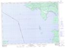
Maps showing Batchawana Bay, Algoma, Ontario
Batchawana Bay is a Unincorporated area located in Algoma, Ontario and has an elevation of 187 meters.
- Latitude: 46° 55' 34'' North (decimal: 46.9261111)
- Longitude: 84° 36' 23'' West (decimal: -84.6063888)
- Topography Feature Category: Unincorporated area
- Geographical Feature: Compact Rural Community
- Canadian Province/Territory: Ontario
- Elevation: 187 meters
- Location: Algoma
- Atlas of Canada Locator Map: Batchawana Bay
- GPS Coordinate Locator Map: Batchawana Bay Lat/Long
Batchawana Bay NTS Map Sheets