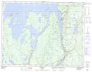
Maps showing McKee Island, Thunder Bay, Ontario
McKee Island is a Island located in Thunder Bay, Ontario and has an elevation of 266 meters.
- Latitude: 49° 29' 26'' North (decimal: 49.4905555)
- Longitude: 88° 14' 16'' West (decimal: -88.2377777)
- Topography Feature Category: Island
- Geographical Feature: Island
- Canadian Province/Territory: Ontario
- Elevation: 266 meters
- Location: Thunder Bay
- Atlas of Canada Locator Map: McKee Island
- GPS Coordinate Locator Map: McKee Island Lat/Long