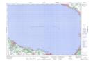
Maps showing The Elbow, Simcoe, Ontario
The Elbow is a Shoal located in Simcoe, Ontario.
- Latitude: 44° 34' 6'' North (decimal: 44.5683333)
- Longitude: 80° 18' 56'' West (decimal: -80.3155555)
- Topography Feature Category: Shoal
- Geographical Feature: Bank
- Canadian Province/Territory: Ontario
- Location: Simcoe
- Atlas of Canada Locator Map: The Elbow
- GPS Coordinate Locator Map: The Elbow Lat/Long
The Elbow NTS Map Sheets